Wrocław 1945: an atlas of destruction and rebuilding
Why is Grunwaldzki Square so wide? Why does a house on the Market Square look older than it is? Explore five places through what stood before the war, what happened in 1945 and what was built later.

One siege. Many layers of history.
Before 1945, the city now called Wrocław was the German city of Breslau. Nazi authorities declared it a fortress in 1944. A forced civilian evacuation and a long Soviet siege followed; the German garrison surrendered on 6 May 1945.
The war devastated large parts of the city. After the borders changed, Breslau became Polish Wrocław. Germans were expelled, new residents arrived from different regions, and rebuilding stretched over decades. A street that looks “old” today may contain postwar reconstruction; an open square may owe its shape to deliberate demolition.
Source: Historical timeline; city history overview (in Polish).
What are you looking at?
Choose a visible feature. The place card reveals what preceded it, what the siege changed and why the site looks this way today.
Choose a place:
Showing: Grunwaldzki Square. Select another place above.
Grunwaldzki Square: an airstrip cut through the city
Name to enter on a map: Plac Grunwaldzki
The wide space between the bridges was cleared during the siege for a makeshift airstrip. Later generations gave it a different role.
A dense network of streets and tenement houses occupied the area.
German authorities ordered buildings demolished to create an emergency airstrip inside the besieged fortress.
The area became a postwar street market, then a university district; the “Manhattan” housing complex and a major transit hub followed.
Source: City of Wrocław: Grunwaldzki Square (in Polish).
Nowy Targ: a market square in a new form
Name to enter on a map: Plac Nowy Targ
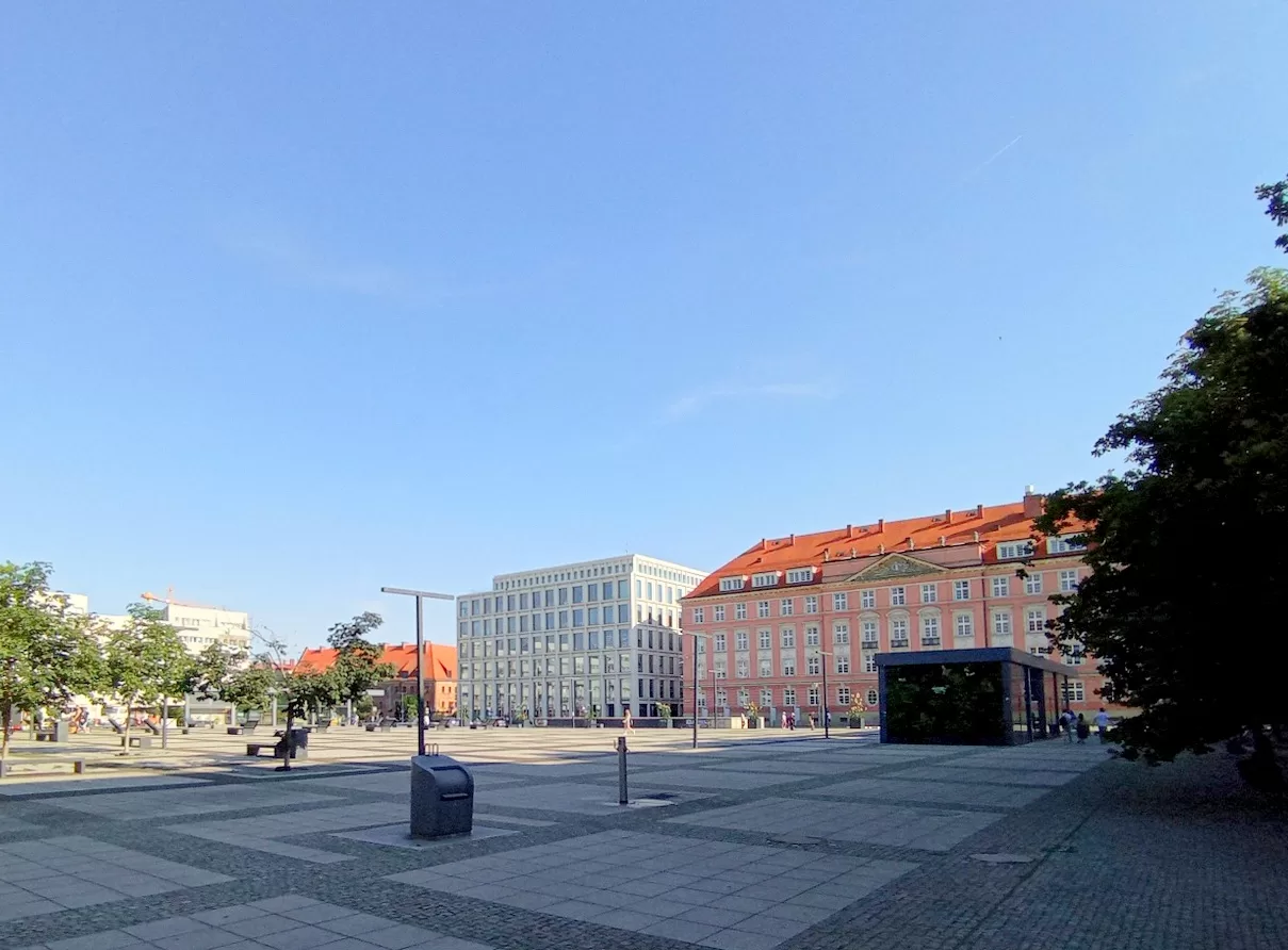
The war almost erased this former trading square. Its present edges and street pattern come from the rebuilding plans of the 1950s and 1960s.
A built-up market square crossed by Drewniana Street.
The square was almost completely destroyed; only a few buildings survived.
New housing blocks enclosed the square, and Drewniana Street disappeared from its centre.
Source: City of Wrocław: the changing Nowy Targ (in Polish).
Rynek 41: a baroque face on a 1990s building
Name to enter on a map: Rynek 41
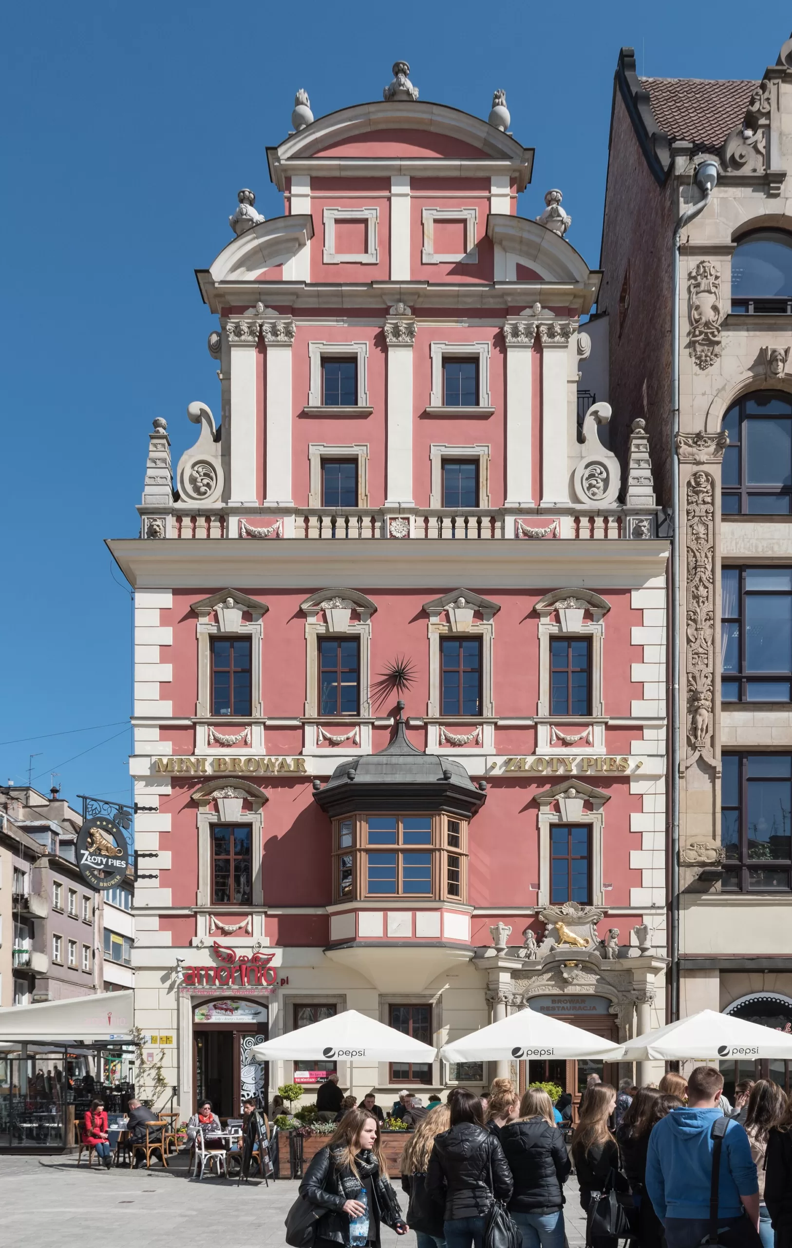
The house called Pod Złotym Psem (“Under the Golden Dog”) looks historic, but the building you see was rebuilt in 1993–1994.
A historic Market Square house acquired a baroque appearance in the eighteenth century.
The house was badly damaged in 1945 and demolished after the war.
It was reconstructed on surviving old cellars, using photographs and plans; its bay window follows a form that predated an 1881 alteration.
Source: City of Wrocław: Pod Złotym Psem (in Polish).

Strzegomski Square: a wartime shelter turned museum
Name to enter on a map: Plac Strzegomski
Here the wartime structure itself survives. The circular shelter outlasted the fighting that devastated much of its surroundings.
A reinforced-concrete air-raid shelter was built in 1942 to a design by Richard Konwiarz.
Fighting reached this area; the shelter was among the few structures to survive.
The building took on new uses. Since 2011 it has housed the Wrocław Contemporary Museum.
Source: Wrocław Contemporary Museum: building history (in Polish).
The cathedral: an old landmark rebuilt after the siege
Name to enter on a map: Archikatedra św. Jana Chrzciciela
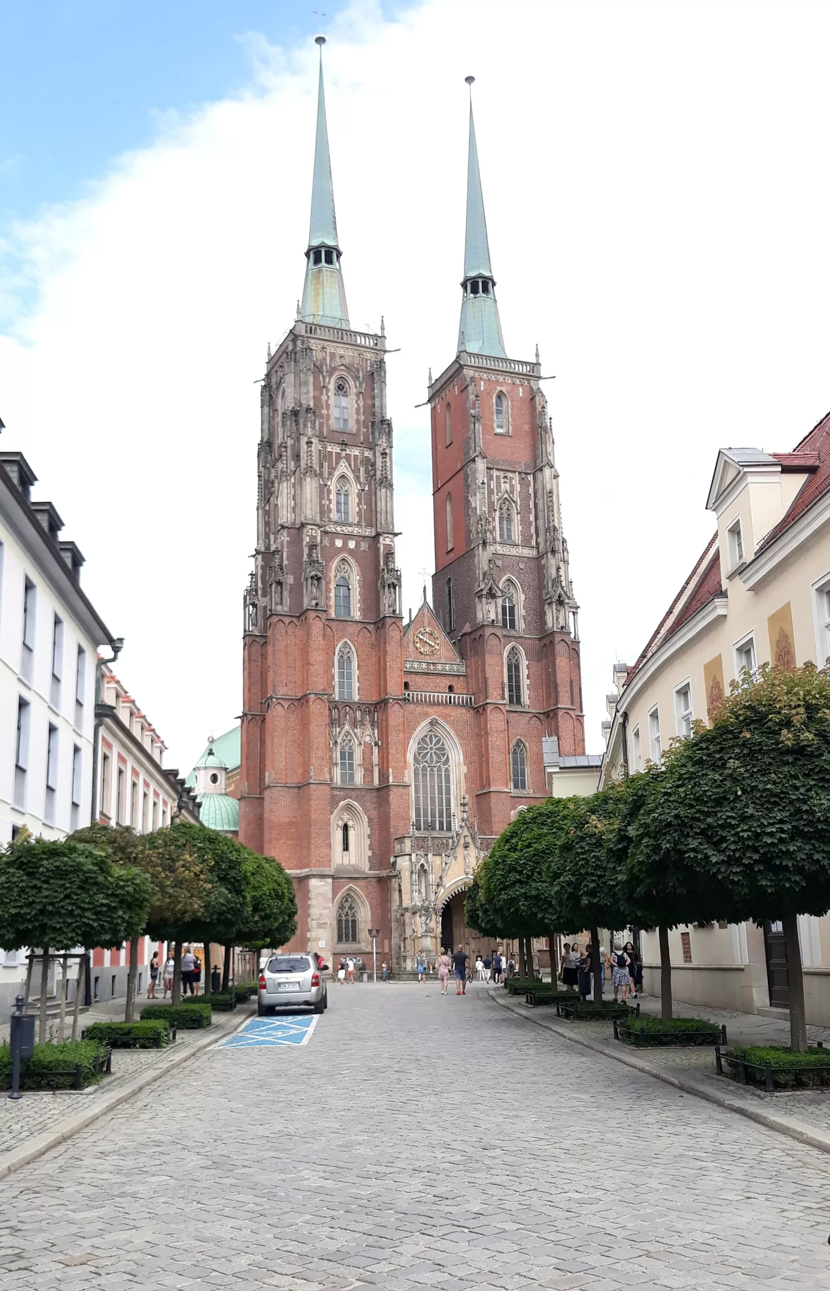
The Cathedral of St John the Baptist combines a centuries-old sacred site with extensive postwar repair.
One of the city’s most important churches stood on Cathedral Island (Ostrów Tumski).
The cathedral suffered heavy damage during the siege.
Restoration followed the war; the rebuilt cathedral was consecrated on 29 July 1951.
Source: City of Wrocław: historical timeline; city history overview (in Polish).
Three questions to ask at any site
A present-day photograph shows appearance. The explanation comes from dates, the former use of the place and the choices made after the siege.
What was here earlier?
A square, a tenement house, a shelter and a cathedral tell different stories. Architectural style and building date can differ.
What changed in 1945?
Identify the documented cause: shelling, fire, deliberate clearance or demolition after the war.
Who shaped today’s view?
Rebuilding could mean a replica, a new design or a new use for a surviving structure.
The city was rebuilt by people, too
Buildings changed alongside the population. Wartime evacuation, the postwar expulsion of Germans and the arrival of Polish residents from many regions all shaped daily life in the new city. Reconstruction meant making homes, services and institutions work again.
The permanent exhibition “Wrocław 1945–2016” at Centrum Historii Zajezdnia explores resettlement and postwar life. Museum information ↗
Editorial research based on publications by the City of Wrocław and Wrocław Contemporary Museum. Photographs show the places today.
